Hiking trails around Isaberg
Isaberg offers a wide range of trails in nature around the mountain for hiking, trail running or regular walking.
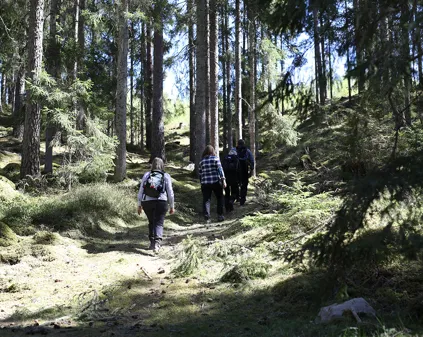
The Isaberg area has many lovely hiking trails of varying lengths. Choose between a high speed, pulse-raising run through challenging terrain or a peaceful stroll through the beautiful nature that can be found around the mountain and the Nissa lakes.
Isaberg hiking trails
Sjöstigen (Red/White) 2 km, 20 altitude metres
Intermediate accessibility with low exertion
Easier hiking by the lake near terrain around the headland on Algustorpasjön.
Hikers and cyclists share the trail for part of the way.
Hestra trail (Green/White) 5.5 km, 160 altitude metres
Easy accessibility with higher exertion
A high hiking trail that runs on a wide gravel road. Also suitable for a pulse-raising runs. Occasional uphill sections, but suitable for pushchairs.
Hikers and cyclists share the trail for part of the way.
Stugbyrundan (Blue) 1.5 km, 30 altitude metres
Intermediate accessibility with low exertion
Exercise circuit around Isaberg's cabins and through the bike park and obstacle course. This hike gives you a good overview of what there is to do in the resort.
Hikers and cyclists share the trail.
Bjärsvedsleden (Black/white) 12,5 km, 280 altitude metres
Easy/intermediate accessibility with low exertion
Isaberg's longest trail in hilly terrain running from Isaberg up to the village of Bjärsved. Horses and cows can be seen in the pastures in summer. Continue on towards Bjärsvedsklint with fantastic views. Then pass Hestra on the hike back towards Isaberg. Ideal longer trail.
Hikers and cyclists share the trail for part of the way
Ettö golf course (Yellow) 6 km, 60 altitude metres
Easy/intermediate accessibility with low exertion
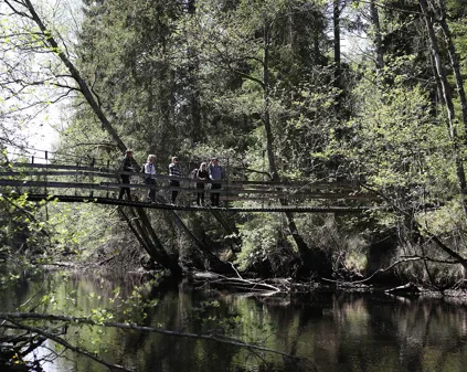
Hiking in partly hilly terrain with a great variety of different environments. A hike from Isaberg to Ettö nature reserve. Then on to Isaberg golf course before turning back towards Isaberg. The hike crosses, among other things, a suspension bridge and a waterfall.
Hikers and cyclists share the trail for part of the way.
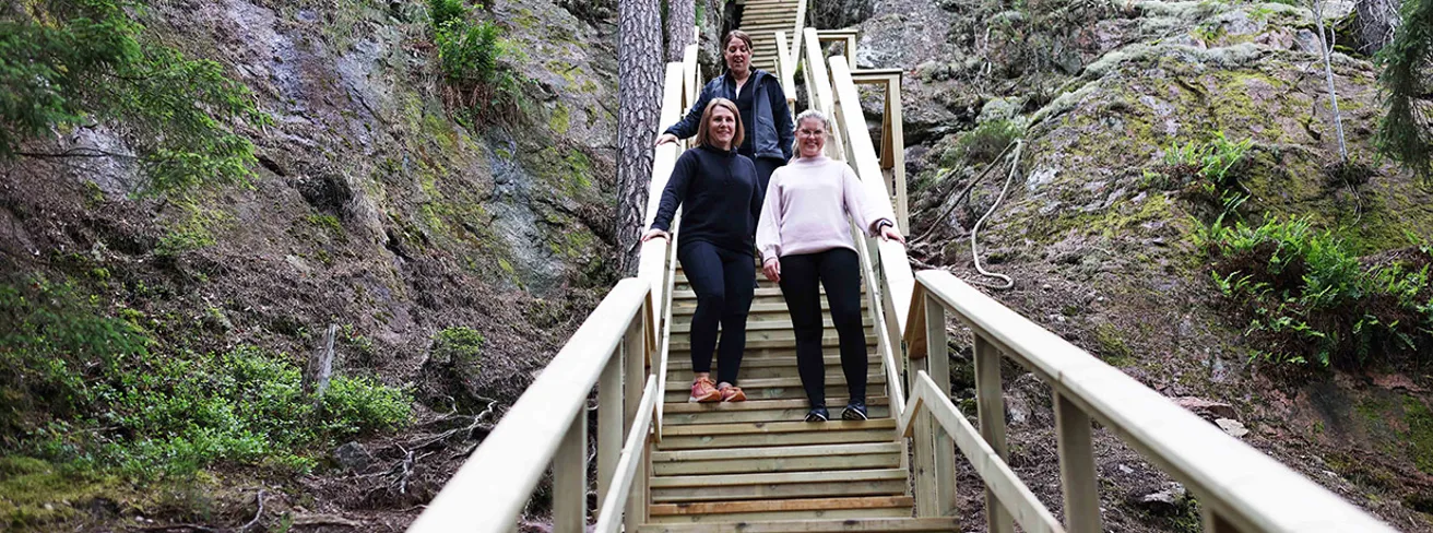
Jättestigen (Yellow/White) 2,8 km, 160 altitude metres
Severe difficulty with high pulse
Embark on an unforgettable adventure through dramatic terrain, where Jättetrappan leads you straight up through a magnificent rock crevice. Step by step, you climb higher - a total of 500 steps and around 160 meters in elevation - until you reach the top and are rewarded with breathtaking views of the surrounding landscape.
Hikers and cyclists share the trail for part of the way.
Järnbäraleden (Orange) 19 km, 310 altitude metres
Intermediate accessibility with low exertion
Intermediate trail that meanders through varied nature and terrain. The trail runs between Isaberg and Gnosjö and on the way you pass Ettö Nature Reserve, Isaberg Golf Course and smaller villages.
Gislavedsleden (Orange) 100 km
Intermediate accessibility with low exertion
Gislavedsleden stretches from Kinnared in the south to Isaberg in the north. The trail passes through two nature reserves, Fegen and Isaberg. The trail goes through both deciduous and coniferous forests, along lakes and through villages with fields and pastures.