Smålandsleden Gislavedsleden
Hike and experience the wilderness
Via Gislavedsleden, which is about 100 km long, you get to experience the landscape of Småland up close: fabulous forests, small forest lakes, red cottages with white detailing and pastures. The trail stretches from Isaberg in the north to Lake Fegen in the south and goes through two nature reserves and a number of fascinating cultural areas.
Gislavedsleden is part of the larger Smålandsleden, which is a system of hiking trails for those wanting an even longer hike. In the south, the trail connects to Hallandsleden and in the north to Höglandsleden via Järnbärarleden.
Length: 100 kms
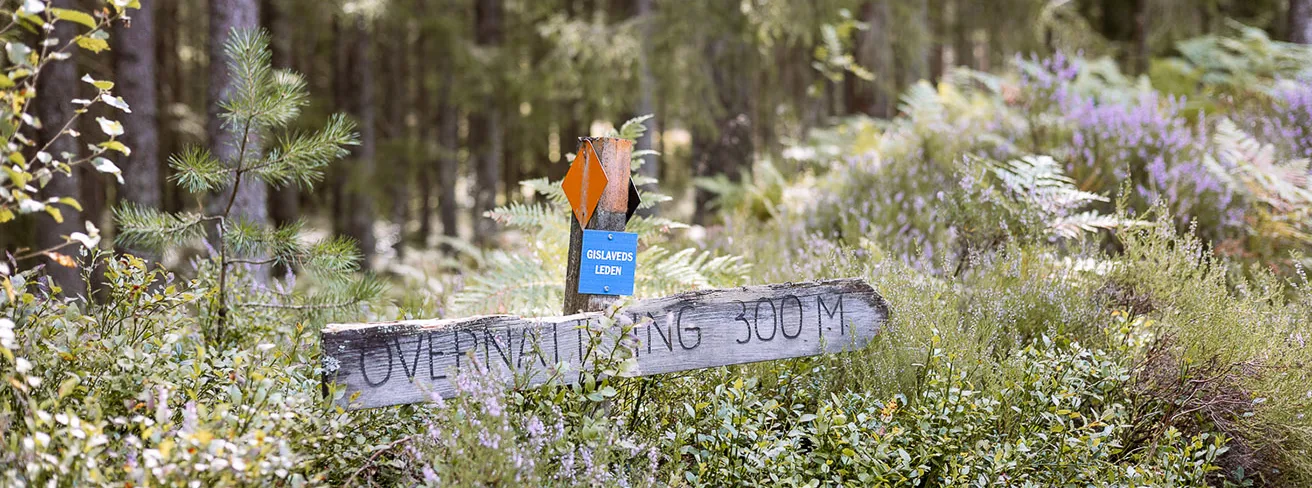
Marking: Orange
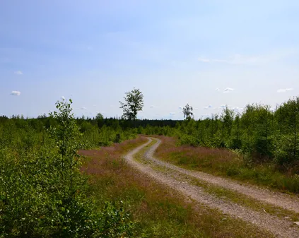
Surface: forest path, gravel road, paved road.
Severity: Easy/intermediate
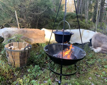
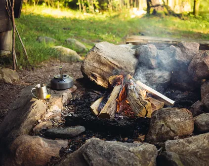
If you want to experience the wilderness and sleep out in the open, there are seven campsites with shelters and fireplaces along Gislavedsleden. You can choose to hike the entire trail which is about 100 km and takes between 4 - 6 days, or just part of the trail. In the section below you can see the distance between the different campsites.
Isaberg - Hägnalian 14 km
This part starts at Isaberg, which is a primeval hill that rises 150 metres above the surroundings. The northern part of the trail is dominated by fabulous coniferous forest and the southern part by Småland's village landscape. The hike takes you mainly on forest trails and gravel roads. The trail ends at Hägnalian campsite, which is located in a sheltered spot by a forest road. There is a shelter, barbecue area, woodshed and composting toilet.
Hägnalian - Mjösundet 17 km
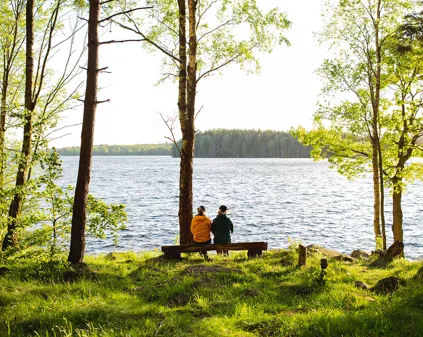
The hike takes you mainly on forest trails and gravel roads. This part is passes several small lakes and Högåsen, which rises 280 metres above sea level and offers beautiful views. Just before Gislavedsleden passes highway 27 and Näs. Here you can fill up with drinking water from a tap on a house gable less than 100 metres from the trail. The rest area at Mjösundet is beautifully situated on a promontory overlooking Lake Majsjön and offers a shelter, barbecue area and composting toilet. On this stage there is a connection to Gislaved for those who want to start or end their hike there.
Mjösundet - Leabo sand 12 km
This part runs through a coniferous forest-dominated area, along the beautiful Lake Majsjön on mainly forest paths and gravel roads. Drinking water is available at the first farm you come to in the small village of Arnåsholm, located between the two lakes Harasjön and Sävsjön. There is a bus stop for those who want to start or end their hike here. Leabo Sand campsite has a shelter, barbecue facilities and composting toilet. A stone's throw from the campsite there is a lovely swimming area with sandy beaches.
Leabo sand - Boberg 14 km
During this stage you will hike into the Fegen Nature Reserve. Water is available at Förshult farm just before the station community of Hällabäck. Hällabäck has a pleasant rest area next to Västerån. In Knavrabo, Gislavedsleden connects to Knavrboleden – an approximately 3 km long nature trail with a viewpoint, picnic cabin and remains of an old mill. The Boberg campsite is located 100 m from Fegen beach and has a shelter, barbecue area, wood storage and composting toilet.
Boberg - Grävlingbackarna 15 km
This part of the trail is mostly inside the Fegen nature reserve, which includes both the lake and its surrounding forests, which mainly consist of coniferous trees but with some deciduous and beech trees. The hike takes you mainly on gravel forest roads and paths. In Sandvik you can connect to the GG trail to continue to Burseryd, which has a bus stop. In Sandvik there drinking water is available on the north end of the parish hall. Grävlingabackarna campsite has a shelter, barbecue area, wood storage and composting toilet and is a secluded spot down by the lake.
Grävlingbackarna – Fegen 12 km (Kollabo 25 km)
On this part of the trail you continue your hike through Fegen's stunning nature reserve. It takes you through several villages with pretty views of Lake Fegen. The trail splits in Barslida. You can choose to continue your hike to the community of Fegen, located on the southern shore of Lake Fegen. There is a bus stop for those who want to start or finish their hike here. You can also continue towards Kinnared and Kollabo, where Gislavedsleden connects to Hallandsleden. Kinnared has a bus and train station. However, the last few kilometres of the trail that cross the provincial border between Halland and Småland are very sparsely marked and to be able to follow it, a map or GPS is required. Kollabo campsite has a shelter, barbecue area, firewood storage and composting toilet.